BAL Assessment Mt Eliza Mornington Peninsula
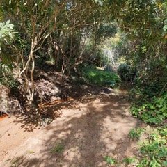
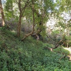
On ground filed surveying yielded good results for the effort put into trudging through the wilds of Earimil Creek in Mt Eliza. Beneath the canopy of Pittosporum Undulatum we discovered a 5 to 6 metre non vegetated fuel break as the creek and its sandy islands and banks meanders along the course . This detail is not seen nor easily distinguished from the aerial photographs of Google Earth and make for a timely reminder of the benefits of onground field assessment.
This break in the vegetation means the vegetation of the reserve can be dealt with in two distinct sections the North Eastern aspect and the South Eastern aspect . Also beneath the canopy is the fire retardant ground covers of wandering jew and cape ivy illustrating the high moisture content of the vegetation that is adapted to grow in the shade and therefore its lower flammability index. This is all part of putting the pieces together to create an understanding of how a bushfire may or may not spread and its intensity and rate of spread. Ah… The importance of ground truthing!


